
Heavy Rain, Flooding, and Chance of Severe Weather Staring Down the Southern U.S.
January 22, 2024
Posted: June 15, 2023 9:30 am


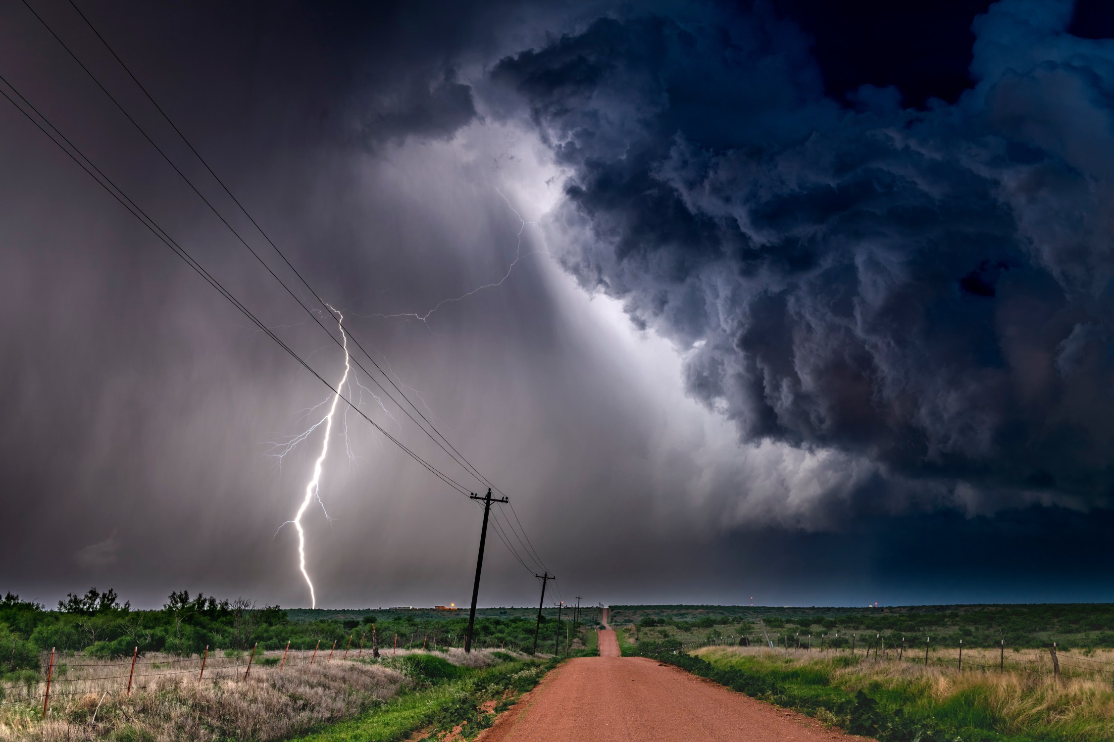
The severe weather trend is forecast to continue across the central and southern portions of the country this week. These storms have already delivered multiple rounds of high winds, hail, and tornadoes to start the week.
Forecasters are warning that the second half of the week will bring the same active weather pattern to this part of the U.S. Here is what you need to know.
Wednesday started with a number of severe storm and tornado watches issued across parts of the South. Emergency management officials reported a tornado was moving on the ground in Abbeville, Alabama on Wednesday morning.
Located just to the west of the Alabama-Georgia state line, the community was put under a tornado warning as it moved to the east.
A large stretch of land from the Front Range of Colorado to the southeastern U.S. will continue to see the chance of daily storms continue through the rest of the week.
Some of the storms could pack severe impacts, particularly in the volatile zone where the cooler air to the north will merge with the warm and humid air to the south. This clash will provide plenty of atmospheric energy for storms to develop.
What area sees the worst of the storms will depend on where the greatest amount of energy is spinning. The general zone will encompass the High Plains through the Southeast.
It has already been a rocky start to the week for many parts of the central U.S. Stormy conditions disrupted air travel in the busy airport hubs in Dallas to start the day Tuesday. These potential disruptions will linger in the coming days, moving east to cities such as Atlanta.
While the Plains states saw the worst of the severe storms on Monday and Tuesday, this threat will shift to the Southeast and the Gulf Coast on Wednesday, Thursday, and Friday.
These storm cells will bring the usual risks of large hail, torrential rain, and strong winds. The conditions needed for tornadoes to spin up will also be present in this zone.
In addition to the possibility of air travel delays, motorists along some portions of interstates 10, 20, 55, 65, 75, and 95 should be aware of the potential of reduced visibility because of the torrential rain. Be sure to check the hourly forecast in your specific community if you are concerned about weather impacting your travels.

Meteorologists are predicting two distinct areas of storm development on Thursday. The first zone will be a continuation of the storms in the central Plains. The storms will first erupt along Colorado’s Front Range.
Denver residents hoping to get out and celebrate the NBA championship Denver Nuggets during the morning parade will likely enjoy dry conditions. However, rain showers and storms are in the forecast for the afternoon. The line of storms will stretch into western Kansas.
It has been a particularly wet June for the Denver metro area. The Mile High City has only seen three days the entire month that did not bring rain. Forecasters are predicting more rain in the short-term outlook with storms on deck for the rest of the week. These storms may also fire up in the mountain areas.
Going back to May 1, Denver has recorded nearly 8 inches of rain. This is good enough to more than double the average for this time period. May ended up being the fourth-wettest May on the record books for the city with 5.53 inches of rain. Nearly 3 inches fell on May 11 alone. The historical average for the month is 2.16 inches.
Through June 12, Denver International Airport has recorded 2.42 inches of rain for the month. This is already more than the historical average of 1.94 inches for the entire month.
While the rain may be messing with outdoor activities in the region, a drier pattern is in the long-range forecast for July through September. With rainfall amounts well below average expected over these three months, the extra moisture now is good news heading into the dry period.
The second area of impact on Thursday will set up along the Gulf coast. This will translate to a stormy day for places such as Mobile, Alabama and across the Emerald Coast of Florida. Beachgoers in the Florida Panhandle will want to keep a close eye on this forecast.
Because many of these areas in the Southeast have already been under the gun for storms and rain this week, the additional moisture could trigger the chances of localized flash flooding. Other potential hazards include hail and high winds. Lastly, weather with these characteristics also are capable of producing derechos.
Friday’s forecast is calling for more storm activity for the southern Plains and the Gulf Coast as heat begins to build over Texas and beyond. Temperatures are forecast to climb into the triple digits heading into the weekend for this area of the southern Plains.
Did you find this content useful? Feel free to bookmark or to post to your timeline for reference later.

January 21, 2024

January 19, 2024

January 18, 2024
