
Heavy Rain, Flooding, and Chance of Severe Weather Staring Down the Southern U.S.
January 22, 2024
Posted: March 30, 2023 2:45 pm


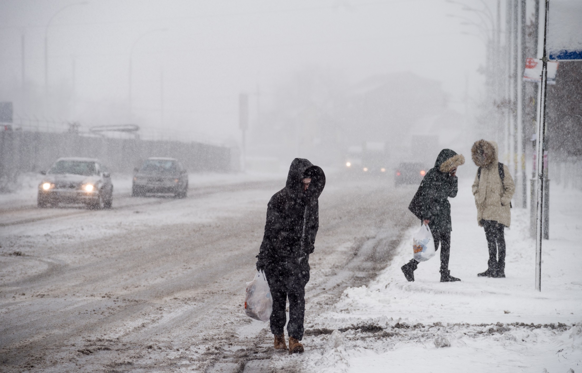
The north-central U.S. is not catching a break when it comes to lingering winter weather. Another snowstorm is targeting this portion of the country, bringing the chance of blizzard conditions as the calendar flips from March to April. Unfortunately for those ready to welcome spring, another winter storm is in the forecast for next week.
Forecasters are growing more confident that a good part of the northern Plains and Upper Midwest will pick up a few inches of snow starting late Thursday and continuing into the weekend. In addition to snow, the storm system will also generate strong winds. This combination of snow and wind could trigger blizzard conditions on Friday and Saturday in an area stretching from the Dakotas into the northern half of Michigan.
This is the same monster system that will also bring the chance of severe storms and tornadoes to the southern half of the country while producing strong winds for the Great Lakes, Ohio Valley, Northeast, and mid-Atlantic. In short, it is going to be a volatile few days of weather for the eastern half of the U.S.
The flakes are set to begin to fall by late Thursday in North Dakota, northern Minnesota, northern Wisconsin, and Michigan’s Upper Peninsula. Some communities will see ice and rain prior to the snow development. This first round of snow is just an appetizer for the snow that is forecast to fall starting Friday in the same general area.
This second punch will be paired with colder air that will support greater amounts of snowfall. This is also when you can expect the strong winds to pick up throughout the region. Travel will be greatly impacted as the snow and wind create the potential of blizzard conditions and drifting snow. The cold temperatures coming in behind this system will ensure that any snow that falls sticks around for a bit, also impacting travel on roadways.
While widespread snow amounts of at least a few inches are in the forecast for a significant part of the northern Plains and the Upper Midwest, the hardest hit areas could pick up 6 inches or more. This includes South Dakota, western Minnesota, and northern Wisconsin. The Upper Peninsula of Michigan could see accumulations of over one foot.
Motorists will want to be aware of the rapidly deteriorating road conditions along portions of interstates 29, 35, 39, 75, 90, and 94. The snow is also likely to thwart some outdoor plans in advance of the Easter and Passover holiday.
This part of the country has seen its fair share of wintry precipitation this season. Some cities and towns have seen snow accumulations land them in the top 10 list of snowiest seasons on record. For instance, the 2022 – 2023 winter season for Minneapolis is currently ranked eighth on the all-time list for the most snow on record. The Twin Cities only needs to see a few more inches to climb into the top five. Forecasters are confident that this storm will push the area into this territory.
This year’s record-breaking snow totals have been a result of the same weather makers that have been pounding California this year. This storm track is set to continue into April, meaning that the Upper Midwest is far from out of the woods when it comes to winter weather.
In fact, forecasters are warning that another system is on deck for next week. This storm will bring renewed chances of snow and high winds. The upcoming event is also likely to carry more of a punch than the current storm.
This track is currently projected to move farther to the north and the west, setting its eyes on the Dakotas and northern Minnesota. Cities currently expected to see the worst of this early week storm include Rapid City, South Dakota; Fargo, North Dakota; and Duluth, Minnesota. At this point, Minneapolis is right on the fringes of the system.
Did you find this content useful? Feel free to bookmark or to post to your timeline for reference later.

January 21, 2024

January 19, 2024

January 18, 2024
