Heavy Rain, Flooding, and Chance of Severe Weather Staring Down the Southern U.S.
January 22, 2024
Posted: July 19, 2023 1:16 pm


The multi-day storm threat across the central and eastern U.S. is showing no signs of mercy. The storms will target a large swath of the country, stretching from the High Plans and up into New England. Here is the latest on this forecast.
Millions of Americans need to be on alert for a number of severe weather threats continuing through this week. This unsettled weather will impact people in the Northeast, the Southeast, the Plains, and the Midwest, bringing threats such as heavy rain, strong winds, and frequent lightning strikes.
What is most challenging about this week’s weather forecast is pinpointing exactly where the storms will pop up. Forecasters are warning that the mid-July heat will provide the groundwork for storms to erupt across over a dozen different zones across the eastern two-thirds of the U.S.
As is typical with this time of the year, the most likely time frame for the storms to fire up will be in the afternoon and evening hours.
A southward dip in the jet stream will allow the long-tracking complexes of storm activity to develop from the Rocky Mountains eastward to the Atlantic coastal area. The storms will expand as far south as the Gulf Coast in the coming days.
Tuesday’s weather impacts provided a good example of how separate zones of storm cells are able to set up hundreds of miles apart. Patches of storms ignited across the Rockies, the northern Plains, and the Tennessee Valley. These cells brought a variety of disruptions, including heavy rain and gusty winds.
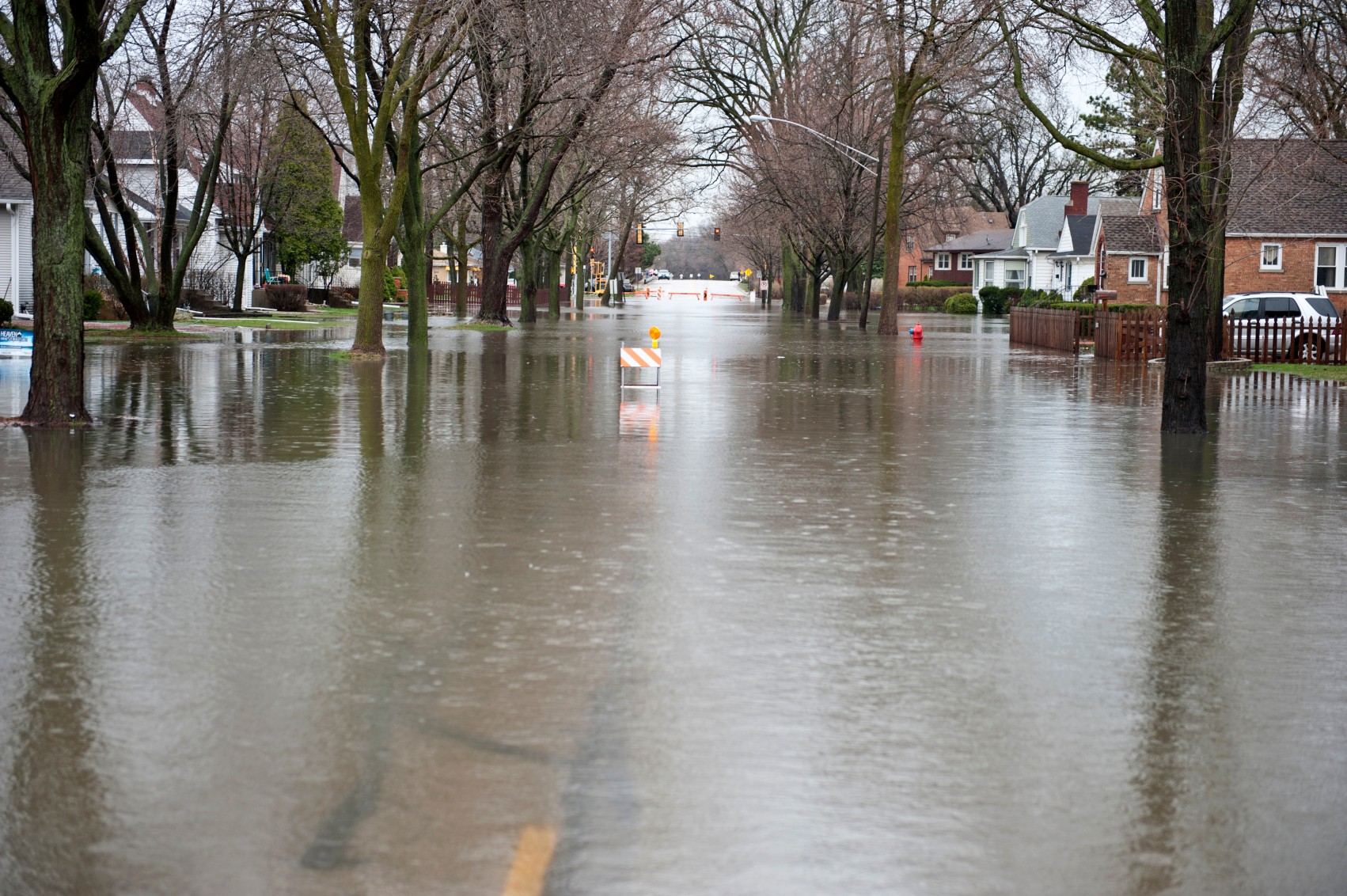
The Northeast also got in on some of Tuesday’s storm action with the most significant worry in this part of the country coming from flash flooding. This is the part of the country that has seen the most notable rain events over the last several days, making the saturated ground more susceptible to flooding concerns.
The storm system that formed in the Canadian prairies and moved across the northern Plains on Tuesday will journey to the southeast on Wednesday, bringing strong winds and the possibility of tornadic activity to the Midwest through Thursday. The storm will then track into the Northeast to bring the work week to a close.
Wednesday’s primary threat will be across the Upper Midwest and down into the northeastern edge of New Mexico. For instance, Minneapolis will be in the crosshairs of afternoon and evening thunderstorms. The highest chance of tornadoes spinning up will also be in central portions of Minnesota.
Another zone of potential storms will set up over parts of Kentucky, Tennessee, and southern Illinois on Wednesday. This energy is part of the same series of storms that got its start on Tuesday over the central Plains states.
Life-threatening flash flooding will be a concern in this part of the nation’s heartland if the torrential rain prediction comes to fruition.
By Wednesday evening, the threat of severe weather will expand to the east, encompassing much of southern West Virginia, Virginia, North Carolina, Delaware, southeastern Maryland, and the southern fringe of New Jersey.

The storms setting up over the northern Plains and Upper Midwest on Wednesday will shift into the nation’s heartland by Thursday. The amount of wind shear circulating in the atmosphere will provide the fuel for the possibility of tornadoes across the Great Lakes by Thursday afternoon.
The Ohio Valley and the western facing slopes of the central Appalachians will also see the risk of severe weather. Cities in the line of fire of Thursday’s severe weather include Nashville, forecast to see thunderstorms to start the day.
This will be an appetizer of more severe weather on tap for the Music City on Friday before conditions finally dry out just in time for the weekend.
In addition, another zone is expected to set up over the Plains states on Thursday, including the areas east of the Rocky Mountains and into western Kansas. These storm complexes could produce isolated tornadoes and large hail as they expand into the central and southern Plains.
The work week will end with a bang for many areas of the middle Mississippi and Tennessee valleys as Thursday’s weather maker moves to the southeast. However, there is still another chance of storms to develop once more across the Rockies in Colorado and up into Wyoming.
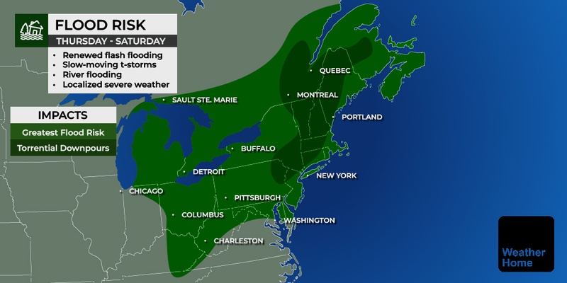
The Northeast will also be a primary impact zone for Friday’s severe weather as the system over the north central portions of the U.S. moves to the east. Unfortunately, the Friday forecast is calling for more rain for parts of the region that were hit by deadly flooding in recent days. This includes much of Pennsylvania, New York state, and Vermont.
After enjoying a break from the rain on Thursday, New York City will once again be at risk of seeing sporadic thunderstorms on Friday. The clouds will keep the temperatures in the low 80s. You can also expect the storms to travel as far north as Boston on Friday. Variable clouds will suppress the mercury with highs expected to hover in the mid 70s in Bean Town.
Looking ahead to the weekend, the persistent dip in the jet stream will encourage more moisture to stream up from the Gulf of Mexico. These ingredients will lay the groundwork for more severe storm development into the weekend and next week. The long-range forecast is predicting that this pattern of stormy conditions will hang on at least through the end of the month.
Did you find this content useful? Feel free to bookmark or to post to your timeline for reference later.

January 21, 2024

January 19, 2024

January 18, 2024