Heavy Rain, Flooding, and Chance of Severe Weather Staring Down the Southern U.S.
January 22, 2024
Posted: July 17, 2023 3:00 pm


At least four people are confirmed dead as the result of rushing floodwaters that have inundated parts of the Northeast this weekend. The fatalities happened when a flash flooding event swept through suburban Philadelphia in Bucks County on Saturday. Here is the latest on this unfolding weather situation in the Northeast.
Local officials confirmed on Sunday that search and rescue operations are continuing in Bucks County, Pennsylvania after a round of thunderstorms dropped torrential rain across this part of the Philadelphia metro area, trapping motorists in their vehicles. At least four individuals have been confirmed dead while crews look for three more missing people.
Authorities found the bodies of two females and one male Saturday night in Washington Crossing, located in the Upper Makefield Township about 30 minutes north of downtown Philadelphia. These three victims were all found outside of their vehicles.
The Upper Makefield Township Police Department announced on Sunday afternoon that they had found a fourth body. Meanwhile, search and rescue teams are looking for an adult female and two young children that were also believed to have been swept away by the floodwaters.
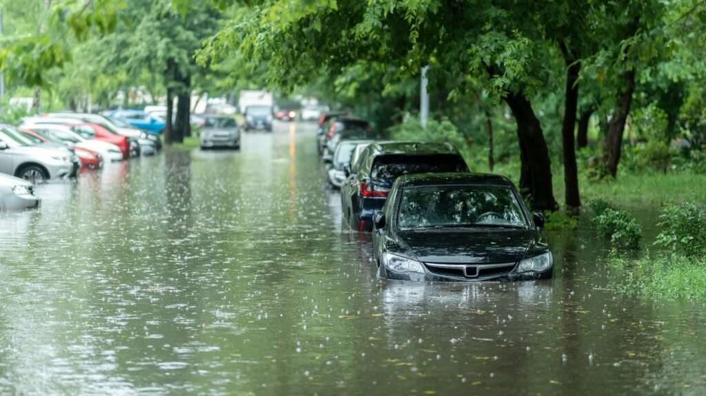
Approximately 6 to 7 inches of rain came down in just a period of two hours in Bucks County on Saturday evening. The worst of the flooding happened along Route 532 between Aqueduct Road and Wrightstown Road in Stonebridge Crossing. Because the rain came on so suddenly, many motorists were caught off guard and became trapped.
About one dozen vehicles were trapped on Washington Crossing Road. Eight people were rescued from their vehicles on this stretch of roadway. This is the location where the fatalities also happened.
Some of the major roadways in the Lower Makefield Township were still impassable on Sunday as a result of the storms. Police are warning people to stay away from the area and to not attempt to drive around police barricades.
The National Weather Service (NWS) had issued a flash flood warning and a severe thunderstorm warning in lower Bucks County on Saturday evening. The event took place in the same general area that experienced widespread flooding last weekend.

The severe weather continued to impact the Northeast on Sunday. A NASCAR Cup Series race scheduled for Sunday afternoon in Loudon, New Hampshire, was postponed as the storms marched through New England. The race is now set to happen at noon on Monday. This part of New Hampshire was under a flash flood warning and a tornado watch only 20 minutes before the race was scheduled to begin.
Air travelers were met with a number of disruptions on Sunday. According to FlightAware.com, more than 700 flights to and from the three major airports in the New York City area were canceled on Sunday. Boston Logan International has also seen over 100 flight cancelations. All of these airports are in a zone that is under an areal flood watch.
The heavy rain is the result of an atmospheric river that is funneling in mass amounts of moisture from the Atlantic Ocean and across the Northeast and New England. Forecasters are predicting that there will be a short break in the rain on Monday with drier conditions expected from the mid-Atlantic up through New England.
The rain will stop over the central Appalachians on Sunday afternoon before relief comes to the mid-Atlantic later in the night.
Despite the respite from the rain, area rivers and streams will still be at risk of flooding heading into the new week. This risk will set up as the water produced by the storm runs into the larger tributaries in the region.
More storms are in the forecast starting late Monday in the Midwest and moving to the east. The weather maker will slow to a crawl as it approaches the East Coast, giving it time to suck in additional moisture from the Atlantic and produce another chance of flash flooding.
Wednesday and Thursday will bring another shot of drier conditions. However, the end of the week will usher in more rain in an area stretching from the central Appalachians and up through New England. You will want to stay tuned to this forecast in the coming days as it becomes clearer.
Did you find this content useful? Feel free to bookmark or to post to your timeline for reference later.

January 21, 2024

January 19, 2024

January 18, 2024