
Heavy Rain, Flooding, and Chance of Severe Weather Staring Down the Southern U.S.
January 22, 2024
Posted: July 20, 2023 3:00 pm


The storm system that is impacting the north-central U.S. on Thursday will push through the Northeast by the end of the week, bringing a renewed risk of flash flooding for this saturated region. Here is the latest information about the next round of rain and storms to impact this corner of the country.
Nobody will blame those in the Northeast for not welcoming this latest round of precipitation. This region has taken it on the chin in recent weeks with a relentless train of storms and all of their impacts. Some communities have recorded up to three months of rain in just a few days.
The hardest-hit areas have been in upstate New York and up through the interior portions of New England. For instance, Albany has seen 9.41 inches of rain already in July. The monthly record for the capital city of New York is 9.91 inches, a record that is sure to fall in the coming days.
It will not take a lot of rain out of this new system to overwhelm grounds that have already been entirely saturated. Area rivers and streams are also at risk of overflowing their banks with just a small amount of new precipitation. This will increase the threat of flash flooding throughout the area from Thursday night through Friday night.
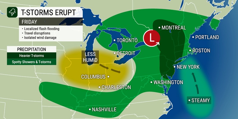
A general half of an inch to one inch of rain is on tap for the Northeast. However, some areas may see 1 – 3 inches of rain. The western slopes of the Appalachian Mountains will see the first of the rain on Thursday afternoon. Localized flooding downpours are in the forecast for this higher terrain.
Friday’s flooding risk will stretch from eastern Pennsylvania and New Jersey up through the eastern part of New York state and the northwestern corner of New England. This is the same area that experienced the deadly flash flooding last Saturday evening.
At least five people have been confirmed dead as a result of this flood event.
The week brought more flooding events to the central U.S. The National Weather Service (NWS) in Paducah, Kentucky issued a flash flood emergency on Wednesday after rainfall up to one foot fell across portions of the state.

The silver lining is that this late-week weather event will move through the region at a fast clip. This differs from last week’s storms that stalled out and delivered more moisture as a result. In addition, there is not a good amount of tropical moisture that is coming up with this storm, limiting the amount of rain that will be available to fall.
The presence of significant cloud cover over the Northeast will also work to mitigate the development of severe weather. This means that most of the moisture will fall as garden variety rain rather than storms with potentially dangerous impacts.
The clouds will also keep temperatures suppressed well below the historical average for this time of the year. Boston will struggle to get out of the mid 70s on Friday while Philadelphia will hover in the mid 80s.
The biggest risk of severe storms will be across the Hudson Valley of New York and into the eastern half of Pennsylvania. New Jersey may also get in on some of this storm action on Friday. Flight delays in some of the region’s largest airports may be a possibility later in the day Friday.
Motorists along the busy Interstate 95 corridor will also want to be aware of the potential of severe weather for the evening commute.
Cooler temperatures will make their way from west to east over the weekend, bringing relief to people who are tired of the summer heat. Drier conditions are also in store for the Northeast by Saturday.
The chance of rain showers may linger in upstate New York and through New England on Saturday, however, the rest of the region will dry out by the start of the weekend.
Overnight lows in major cities such as New York City and Boston may see overnight lows fall into the upper 60s over the weekend. The interior Northeast is forecast to experience overnight lows in the 50s.
For instance, New York City is forecast to see highs in the low to mid 80s with the mercury topping out at about 83 degrees for a high in Boston. The temperatures will begin to climb once again by the middle of next week.
The shot of dry air will also serve to push out some of the smoke and haze that has settled over the Northeast from the wildfires burning in Canada.
Did you find this content useful? Feel free to bookmark or to post to your timeline for reference later.

January 21, 2024

January 19, 2024

January 18, 2024
