
Heavy Rain, Flooding, and Chance of Severe Weather Staring Down the Southern U.S.
January 22, 2024
Posted: April 3, 2023 3:00 pm


An early April snow storm is already in action across the Intermountain West with the northern Plains next in its path. Some portions of the north-central U.S. are already under blizzard warnings as the storm approaches. Here is the latest on this early spring snow storm.
The interior West is currently dealing with the heavy snow and strong winds associated with this system. Forecasters are warning that it could become more dangerous as it moves to the northeast in the coming hours. The primary impact zone is the same parts of the country that experienced localized blizzard conditions just a few days ago.
This week’s event is forecast to bring the heaviest snow to an area north of the Great Lakes, stretching from eastern Wyoming and western Nebraska, through the Dakotas, and into the northwestern corner of Minnesota.
The impending storm could be one of the biggest snow producers of the last several months for some areas of the northern Plains. This is particularly true for the Dakotas. For instance, while Rapid City, South Dakota saw its fair share of storms this winter that delivered 5 – 10 inches of snow, this upcoming system is predicted to bring 1 – 2 feet of the white stuff.
The National Weather Service (NWS) issued a number of blizzard warnings for the western edges of the Dakotas and Nebraska and across to eastern Wyoming. Forecasters are warning that this storm has already delivered on its promise of high winds as it roared through the Intermountain West over the weekend. For example, wind speeds of 75 mph were recorded in Colorado at Monarch Pass in Colorado on Sunday.
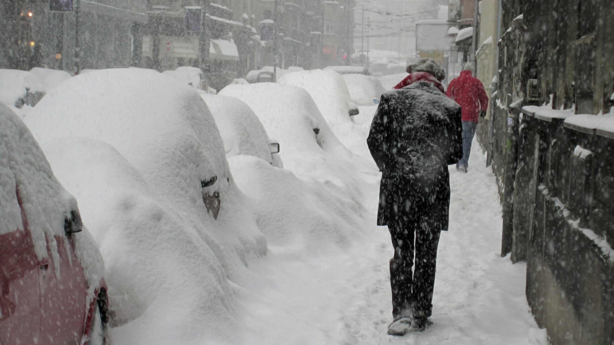
This part of the West has also seen significant snow out of this weather maker. Salt Lake City experienced a dicey morning commute on Monday and it is expected to continue through Tuesday evening, bringing a total of 6 – 10 inches to the city by the time the system exits. The higher terrains of the Wasatch Range will pick up 4 – 6 feet of new snow.
The white stuff will continue its trek to the northeast on Monday and into Tuesday. The high winds will quickly follow, gusting up to 60 mph in the Dakotas.
Motorists will want to take caution when taking to the roads. Travel conditions will rapidly worsen with snowfall rates hitting 1 – 2 inches per hour creating poor visibility. The strengthening winds will only serve to lessen the visibility as the snow starts flying.
Local officials are cautioning that many major highways and secondary roads may be closed because of the potential of blizzard conditions. Even if the official standards of a blizzard are not met, heavy snow and gusty winds will certainly create problems in the form of blowing and drifting snow.
The open spaces over the Black Hills in South Dakota will be ground zero for the snowfall, potentially seeing 3 or more feet of snow. The snow will continue to add to the record-setting snowpack in parts of Minnesota. Duluth is currently sitting at 130.4 inches of snow on record for this winter season. The city only needs to pick up 5 more inches to break the record for the snowiest winter on record. This happened in 1995 – 1996 when the city saw 135.4 inches of snow.
In addition to the blizzard conditions, the strong winds coming in with this storm will also trigger power outages. It will also be bitterly cold throughout the region. Although the temperatures will not rival what you would expect during a storm in the middle of the winter, the mercury will still fall into the teens in the overnight hours on Tuesday. Real feel readings may fall below zero when the winds start whipping around.
Lake Superior is likely to experience waves of up to 20 feet on Wednesday and Thursday at the hands of the strong winds. This will be a dangerous day for even large vessels out on the lake.
The warm side of the storm system will create severe weather starting Tuesday afternoon and lasting through Wednesday evening. The primary zone of concern is the same part of the central U.S. that saw the tornado outbreak on Friday and Saturday.
Flooding issues will be the major issue of concern in the areas south and east of the snowfall zone. Rapidly melting snow will create the chance of flooding of secondary rivers later in the week in parts of central and Minnesota as well as central Wisconsin.
Did you find this content useful? Feel free to bookmark or to post to your timeline for reference later.

January 21, 2024

January 19, 2024

January 18, 2024
