
Heavy Rain, Flooding, and Chance of Severe Weather Staring Down the Southern U.S.
January 22, 2024
Posted: August 1, 2023 3:00 pm


It is shaping up to be another miserable week of weather for much of the central U.S. as oppressive heat and frequent storms are not letting up. Here is an inside look at this forecast.
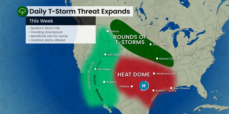
The stubborn heat dome positioned over the south-central U.S. is not expected to budge any time soon. As a result, the southern Plains will continue to see searing temperatures as storms ignite over the northern periphery of this area of high pressure.
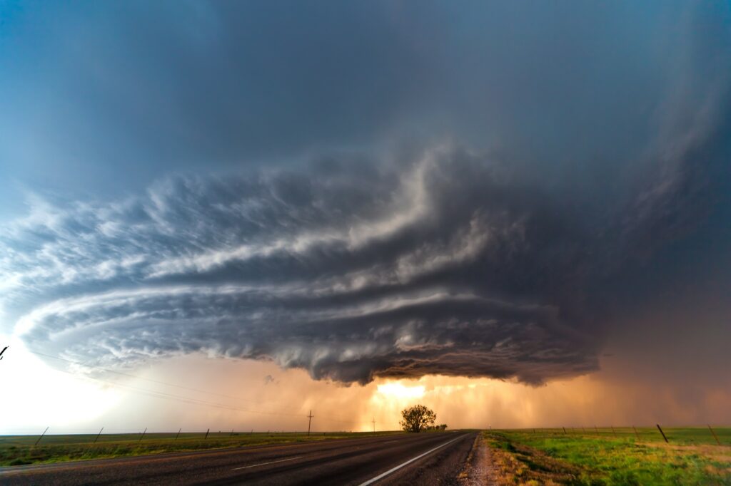
The storm cells will set up on the northern edge of the heat dome, impacting a large area of the Plains and the Mississippi Valley throughout the week. Residents in this part of the country need to be aware of the potential of flash flooding as the storms will pack heavy rain.
While the northern half of the nation’s heartland will enjoy cooler temperatures when compared to the southern half, it will come at the cost of a train of storms.
Texans will not be the beneficiary of any significant moisture this week. Instead, the Lone Star State will sizzle under the high pressure and brilliant sunshine. The major cities of Dallas, San Antonio, Austin, and Houston are all expected to see readings in the triple digits for several days in a row.
The temperatures could end up being the hottest of the year for this region of the southern Plains. In addition to Texas, Mother Nature will crank up the heat for Oklahoma and the western edge of Louisiana in the coming days.
Although heat is the norm for this time of the year, the mercury is forecast to trend about 5 – 10 degrees above normal for early August.
When could the cooler air reach Texas?
The dome of high pressure is expected to move farther to the west as it shrinks in size starting this weekend. Additionally, the storm action to the north may stretch down into the Mississippi Valley at this time, helping to cool the temperature slightly across the southern Plains. These storms are forecast to bring a bit of relief to parts of northeastern Texas, Louisiana, and Oklahoma.
While the southern Plains is baking, the central Plains and the Upper Midwest will be dealing with their own weather hazard in the form of regular rain showers and thunderstorms. The energy located at the northern edge of the heat dome will fuel the development of this unsettled weather pattern.
The storm complexes will be further aggravated by the frequent surges of cooler air coming down from Canada, working to ignite new storms and reinforce those energy sources already in place. The most likely zone for these trains of storms will be across the northern Plains and into the Great Lakes.
Tuesday’s risk of storms will be centered across eastern Wyoming and down into the northeastern corner of Colorado and across Nebraska. The line of activity will expand into the northeastern corner of Kansas, Missouri, and the southern fringe of Iowa. The primary threats with Tuesday’s storms will be large hail, strong winds, and flash flooding.
Another line of storms is expected to fire up on Tuesday farther to the north, including all of North Dakota, the northern half of South Dakota, and into central and northern Minnesota. The usual impacts will accompany this batch of severe weather.
These storms will move to the southeast by the middle of the week. To the east, the storms will hit parts of northern Michigan and Wisconsin on Wednesday.
In addition, the monsoon moisture in the Southwest will push to the north and east on Wednesday, bringing the chance of storms and heavy rain to parts of western Wyoming, including both Grand Teton and Yellowstone national parks. Tourists will want to be aware of the possibility of storms popping up seemingly out of nowhere.
Despite the recent rounds of torrential rain for the Midwest and the central portions of the Plains, there are still pockets of land in need of moisture. The worst drought conditions are currently located in parts of western Kansas, Nebraska, Missouri, and Wisconsin.
Any rain now will be particularly welcome as many of the local crops are in need of moisture during this phase of the growing season. However, the rain could also set off flash flooding that does more harm than good.
Several inches of rain could be in the cards for the heaviest hit areas of Colorado, Nebraska, Missouri, and Illinois this week. Areas that see repeated downpours will be most at risk of experiencing flooding.
Did you find this content useful? Feel free to bookmark or to post to your timeline for reference later.

January 21, 2024

January 19, 2024

January 18, 2024
