
Heavy Rain, Flooding, and Chance of Severe Weather Staring Down the Southern U.S.
January 22, 2024
Posted: May 4, 2023 3:30 pm


While the eastern portions of the U.S. should enjoy a relatively tranquil weekend, it will be a different story for much of the central portion of the country.
The energy from a storm that originated on the West Coast will merge with moisture from the Gulf of Mexico to create thunderstorm activity for this region.
While the incoming storm action will hopefully provide some relief for areas still dealing with a long-term drought, the weather maker will also deliver its own set of hazards.
The first disturbance will eject from the Rockies on Thursday, bringing the impacts to the southern Plains by the afternoon and evening hours. Cities in the possible impact zone include Fort Worth, Austin, and Oklahoma City.
The line of storms could extend as far south as the Rio Grande River at the border with Mexico and as far north as southern Kansas.
Forecasters are warning that large hail could accompany Thursday’s storm system. Hail the size of golf balls is a good possibility in an area that was just slammed with baseball-sized hail last week.
Friday’s storms are predicted to set up in an area stretching from central Texas, into Arkansas, and through western portions of Tennessee.
More storms are expected over the week over a large portion of the central and southern Plains. As is typical for storms of this nature, the most likely time frame of development will be during the afternoon and evening hours.
Saturday’s threats will be focused in an area from central Texas, into the eastern portion of Oklahoma, the bulk of Arkansas and Louisiana, and into the southwestern corner of Missouri.
These storms are expected to bring large hail and damaging wind gusts to cities such as Houston, Dallas, Little Rock, and Shreveport.
Sunday’s activity will drift farther north, encompassing portions of northeastern Kansas, western Illinois, Iowa, Missouri, and Nebraska. This includes the cities of Kansas City, Omaha, Des Moines, and St. Louis.

While all of this storm activity may seem like a lot, it is important to remember that May is typically the most common month for severe weather for the nation’s heartland.
For instance, the National Weather Service (NWS) Storm Prediction Center (SPC) reported that the last three Mays on record recorded the highest amount of tornadic activity.
This weekend will be no exception with the risk of tornadoes throughout a large portion of the central Plains. Forecasters are warning that Sunday into early next week will feature the necessary ingredients to produce a tornado outbreak.
The silver lining of this severe weather is that it will hopefully bring rainfall to drought stricken portions of the Great Plains. According to the latest update from the U.S. Drought Monitor, this part of the U.S. is currently experiencing the worst drought conditions in the country.
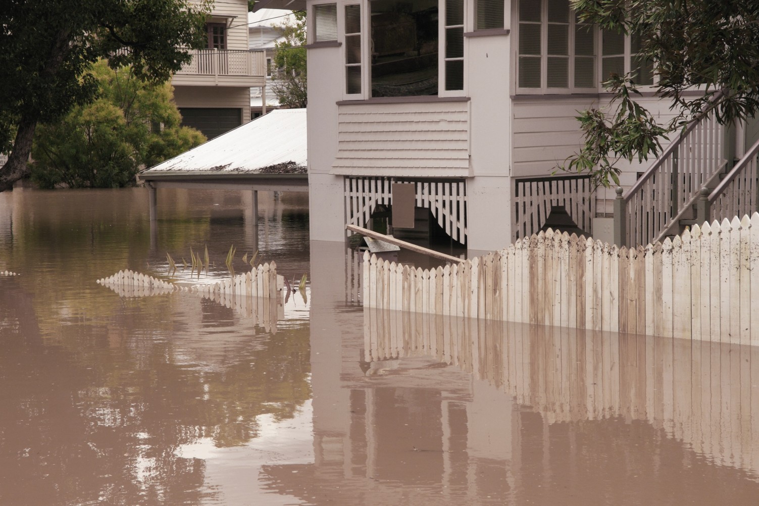
Unfortunately, this rain will also come with the risk of localized flash flooding over the next few days. By the end of the weekend, the risk of flooding will move into the northern Plains and the Upper Midwest.
Local officials have been warning for days that rising water levels across the upper Mississippi River could trigger flooding.
This flooding is already an issue for some riverfront towns. Davenport, Iowa has been dealing with this flooding on a large scale with the Mississippi River sitting at about 21.5 feet above crest level.
Residents have been forced to evacuate their homes as water continues to rise.
It has only been four years since communities along this portion of the Mississippi River experienced disastrous flooding that touched every part of life. Since that time, the city of Davenport installed military-grade HESCO barriers to protect the area. These massive sandbags are currently holding up as hoped.
Davenport is preparing to launch a $165-million flood protection initiative. Plans include raising the height of key roadways and improving the city’s storm sewer systems so that they can take on more water.
Additional funding from the U.S. Congress will help to pay for these improvements for many cities and towns located in vulnerable areas along the Mississippi River.
The risk of flooding is expected to decrease in the coming weeks as the levels drop.
Did you find this content useful? Feel free to bookmark or to post to your timeline for reference later.

January 21, 2024

January 19, 2024

January 18, 2024
