
Heavy Rain, Flooding, and Chance of Severe Weather Staring Down the Southern U.S.
January 22, 2024
Posted: June 14, 2023 12:06 pm


The Northeast is in for a period of cool and unsettled weather this week. While last week’s dip in the jet stream brought down unseasonably cool temperatures and the presence of wildfire smoke from Canada, significant moisture will be the story for this week’s weather pattern.
Here is the latest on the forecast for the northeastern corner of the U.S.
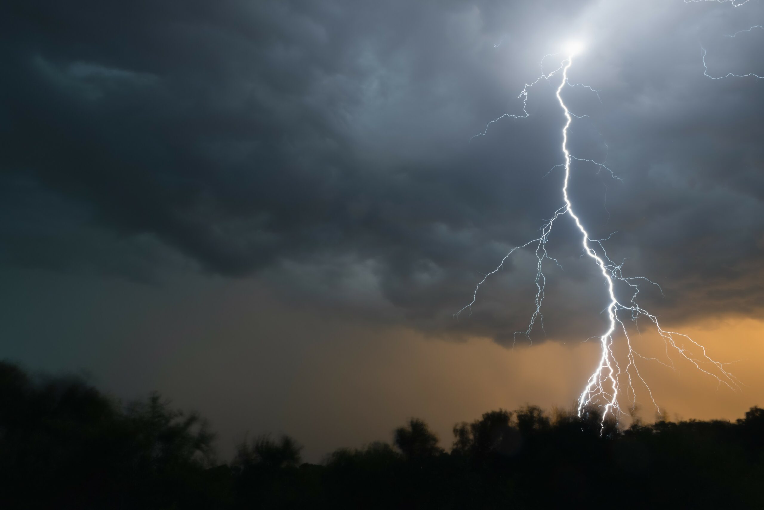
Another southward plunge in the jet stream is ushering in the chance of severe weather for the Northeast this week, particularly along the heavily populated Interstate 95 corridor.
The storm system began to pick up steam on Tuesday as it spun over the Great Lakes. The weather maker is forecast to move to the south as the week continues.
The winds generated by this storm will help to clear out the smoke that has gathered in the atmosphere across the Great Lakes. The system will also trigger severe storms along the leading edge of the front.
The areas most at risk of seeing storms pop up include eastern Pennsylvania into New Jersey and into eastern portions of New York state and the southern and central parts of New England.
The storms will be fueled by the strong June sunshine beginning around mid-day on Wednesday. Forecasters warn that the rain could stall out over some areas, creating the risk of flash flooding. Small hail and frequent lightning strikes are other issues to be concerned about with this storm system.
Motorists taking to the road along Interstate 95 in and around Philadelphia and New York City will want to be aware of the potential of stormy conditions. The storm cells may also impact travel in Long Island, the Berkshires, the Hudson Valley, and the Connecticut Valley.
Air travelers should also anticipate the possibility of delays as storms move through the East Coast. Hubs that may be impacted include those in New York City, Boston, Newark, and Philadelphia.
The mercury is expected to plummet as the storms move through, sending the temperature down 10 to 20 degrees in a short time. In addition to the Northeast seeing a good amount of moisture, the Great Lakes and northern Appalachians will also see significant rain on Wednesday.
This rain will be in addition to the moisture that fell across the Midwest and into the Northeast to start the week. While the rain has wreaked havoc on outdoor activities, the region was in dire need of a good soaking as drought conditions were beginning to take hold.

Thursday will bring slightly warmer temperatures as the sun makes an appearance across the I-95 corridor and beyond. However, another storm system is on the horizon, bearing more rain and cooler temperatures for the region in the coming days.
The next system will fire up across lower Michigan and into Ohio and western portions of New York beginning Thursday afternoon and evening. This disturbance is forecast to stall over the Northeast to close out the work week, bringing even more rain to the area.
These storms may stretch as far south as the Appalachians and over to the Atlantic coastline. In addition to a good soaking rain, the pattern will also encourage the development of gusty thunderstorms along with another burst of unseasonably cool air.
The storm system will linger through Saturday for much of the East Coast. However, Sunday is predicted to bring warmer air and drier conditions thanks to a high pressure system that is growing in Canada and pushing into the U.S.
Unfortunately, this movement may also bring more smoke from the wildfires burning in Quebec down into the Northeast by the weekend. While the air quality conditions are not expected to deteriorate to the levels that the Northeast experienced last week, there may be a noticeable haze in the air.
Over 12.3 million acres have burned in Canada since the beginning of the year. According to the Canadian Interagency Forest Fire Centre (CIFFC), the province of Ontario had over 70 active fires raging on Tuesday.
Winds coming from the north and the northeast have been sending the smoke into the Upper Midwest this week. The good news is that this smoke has not severely impacted air quality levels.
Did you find this content useful? Feel free to bookmark or to post to your timeline for reference later.

January 21, 2024

January 19, 2024

January 18, 2024
