
Heavy Rain, Flooding, and Chance of Severe Weather Staring Down the Southern U.S.
January 22, 2024
Posted: June 7, 2023 3:00 pm


Forecasters are warning that the unusually dry weather pattern that has set up across the Midwest and the Northeast will continue to accelerate the ongoing drought while raising the risk of wildfires. When will relief come?
Here is the latest on this forecast.
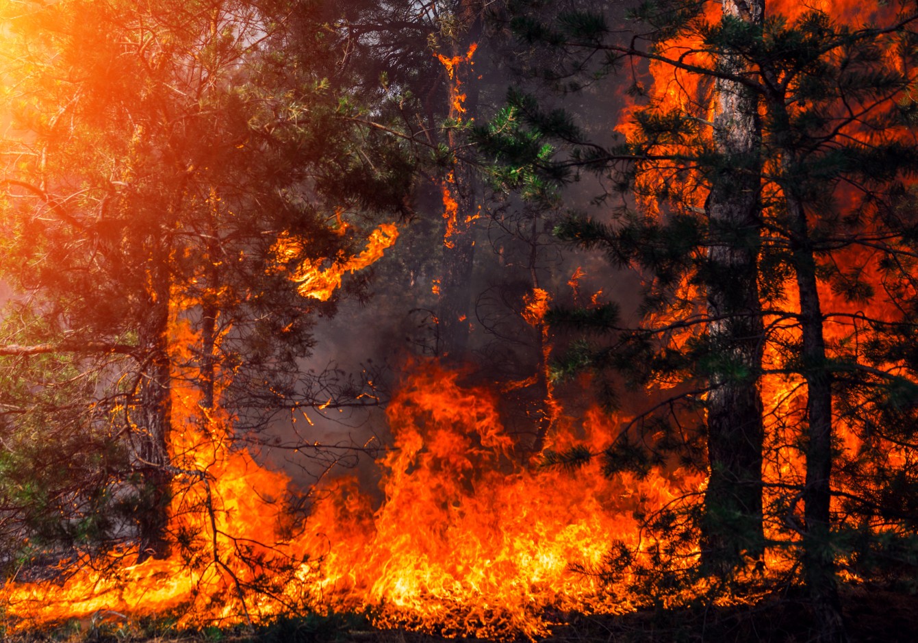
Drought conditions are becoming more widespread across a large portion of the Midwest and the Northeast due to a persistent lack of moisture. The rain that is falling is often coming in the form of thunderstorms, raising the risk of lightning strikes that could trigger wildfires.
The threat of fire danger is predicted to remain high across the Midwest, the central Appalachians, and the mid-Atlantic well into next week. This risk will remain in place even as the mercury starts to cool down.
The cooler weather is the result of a southward dip in the jet stream that took root last weekend. Meteorologists expect this dip to remain in place until early next week across the Northeast. As a result, cooler temperatures will filter down from Canada.
This cooler weather pattern will support the development of rain showers for some areas of New England. However, the rest of the Northeast and the Midwest will likely be left out of any meaningful precipitation for up to a week.
The only chance of rain will come with the risk of dry thunderstorms. These storms are distinguished by their lack of moisture and frequent lightning strikes. The lightning concerns climate experts who point to the possibility of a flash drought translating into dry ground that more easily catches fire.
The ongoing breezy conditions will further increase the risk of wildfires as the winds whip up any embers.
Some portions of the mid-Atlantic were put under the designation of a critical fire danger on Tuesday because of the dryness. The National Weather Service (NWS) Storm Prediction Center (SPC) also put some areas of Michigan and Ohio under an elevated fire risk through at least Wednesday night.
This is especially alarming as the early parts of June are typically when you would expect to see the vegetation become greener and more lush. Instead, the grounds are brown and dry, providing fuel for even the smallest spark.
Dry thunderstorms are more common in the western U.S. during the late summer and early fall months. These weather events are frequently to blame for the rapid spread of wildfires in this region.
You do not need a degree in meteorology to understand that dry brush and grass paired with lightning and gusty winds can quickly start and spread fires.
It has already been a rocky start to the wildfire season for the Northeast. A blaze last week in the Bass River State Forest in New Jersey scorched over 5,000 acres before it was brought to containment. Fortunately, there were no fatalities associated with this wildfire.
Residents in the impacted areas are being urged to exercise caution when operating barbecue grills or using campfires.

It will feel more like early May for much of the Northeast. The mercury will drop the lowest across the interior Northeast over the coming days. However, the mid-Atlantic coastal regions will also be the recipient of these cooler readings.
While the temperatures will begin to inch up on Wednesday in New York City, an incoming mass of cool air will bring the temperatures back into the upper 60s and low 70s on Thursday and Friday before climbing back to near 80 degrees by the end of the weekend.
This warmth will be short-lived with temperatures forecast to fall back into the low to mid 70s to start the new work week. The Big Apple typically sees readings in the high 70s during the second week of June.
Overnight temperatures will also fall below historical averages thanks to the low humidity in place. Readings in the 40s and low 50s will be the norm for most of the interior Northeast over the next week.
It will be even chillier across some portions of the Great Lakes, For instance, Chicago will top out in the 60s for highs on Sunday and Monday.
In addition, the smoke filtering down into the Great Lakes and the Northeast from the wildfires burning in Canada may also work to further suppress daytime high temperatures. This is because the sun has a more difficult time breaking through the smoke to heat the air.
The chance of rain and thunderstorms will ramp up heading into next week for the Plains and the Midwest. This pattern will eventually track farther eastward, giving forecasters hope that the drought may begin to erode by the end of June.
As the rain picks up, the temperatures are also expected to reach levels more typical of this part of the early summer.
The long-range forecast is calling for more thunderstorms well into July with the dry and hot pattern taking hold in August. As a result, the drought may come on again in parts of the Midwest and the Northeast.
Did you find this content useful? Feel free to bookmark or to post to your timeline for reference later.

January 21, 2024

January 19, 2024

January 18, 2024
